Franco-German Frontier [ASE label]
Photographic Image
Identifier:
2016.3.1.1-107
Description
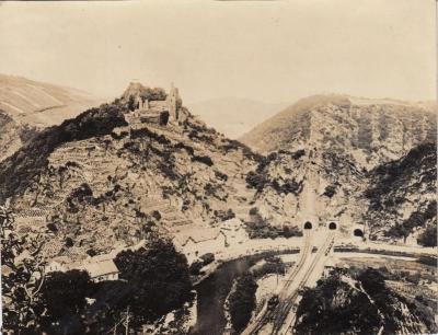
Aerial view of a town with three tunnels into the surrounding hills - two for railroad access and one road. Ruins of a large building top one of the hills, with farmland/vinyards cultivated on the sloping sides. A river or canal runs through the bottom third of the image.The location is possibly along the Marne-Rhine Canal which runs though Alsace, and connected Paris with eastern France and Germany.